In trying to better understand the life of my ancestors, I usually study maps from different time periods of the area in which they lived. Knowing how the landscape changed over time can offer clues to choices the family made such as relocating or marrying someone from another village. I also like to have this background information in case I ever visit the area because what I would see today might not have been what was there during my ancestor’s lifetime.
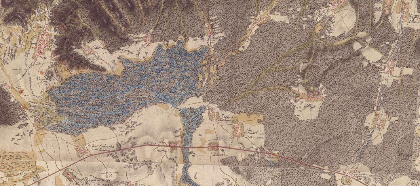
For example, this was what I discovered when I recently found myself browsing the Military Survey maps linked from the Gesher Galicia website. The one in particular I started looking at was from the last 1700s and according to the Gesher Galicia site was the first military survey of the Austrian Empire. The screenshot shown at the beginning of this post is an area of that map zoomed into the vicinity around Ubrez, Slovakia, the ancestral village of my maternal blood line – the Kabai (Kabay) family. Ubrez is located in the small clearing in the right. Based on the legend for this map, what I thought at first was a large forest surrounding Ubrez was actually instead shrubs. Of course my translation of the legend might not be entirely accurate, and trees might have also occupied this area along with the shrubs.
The map site also has a 3D view option. As the screenshot below shows there is a mountain range to the north of Ubrez. Based on a Google search of this area, it appears these are the Vihorlat Mountains, named for the highest peak. Something else I noticed is a large area also shown with shrubs, but layered with blue coloring and the words “Platto Wald” which translates to “flat forest.” You can see this area to the left of the screenshot shown at the top of this post. The blue along with the flatness of the area specifically called out leads me to believe this was a wetland environment.
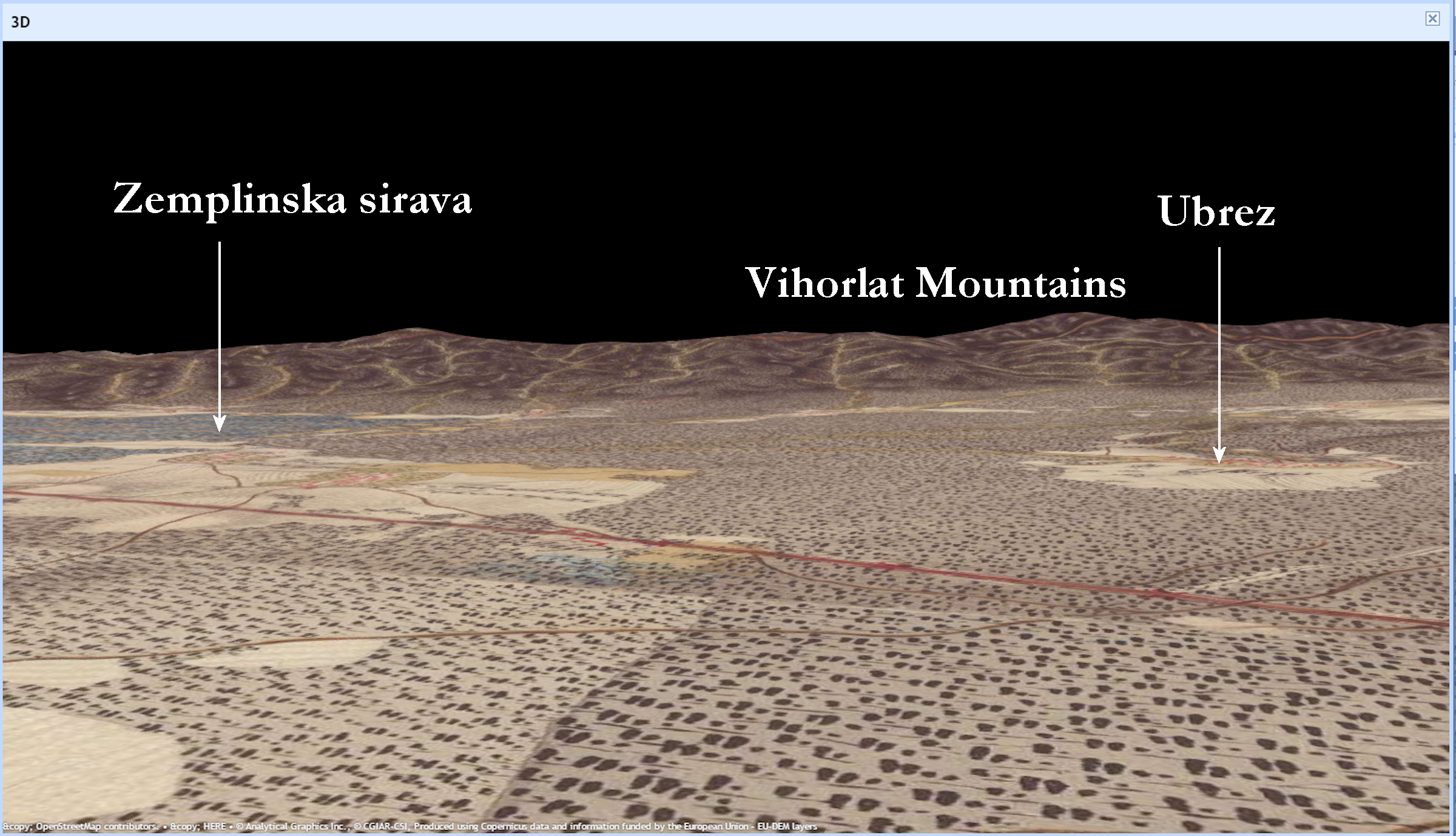
Usually when I view older maps, I end up comparing them to a modern map on Google. What I realized for this particular area is there is now a large lake in the same location as the Platto Wald on the map from the 1700s. Because the lake located there today definitely looked like more than just a wetland feature, I could not imagine this area filled up with water that much over roughly 250 years. So I researched the lake a little more on Google, found it is called Zemplinska sirava, and was created as a result of a dam installed in the 1960s.
When I see major features like this wetland area, I take measurements between my ancestor’s village and the feature to see if it was reasonable to believe they might have visited the area. The measuring tool on the map site gives a distance of 6.5 km (~4 miles) if someone walked along the northerly road through Kussin and 5.75 km (~3.5 miles) if they took the southerly road through Hnojna. While this might take about an hour and a half to walk, it is close enough my ancestors might have regularly walked to the wetland area. If they were allowed to hunt there, it could have provided a good place to capture waterfowl or other wildlife to supplement their diets.
Another feature I noticed is the cleared area around Ubrez. The lines on the map make me think this was an area farmed by the community which makes sense because most people in rural villages supported themselves through farming. Again using the map tools, the area around Ubrez shown as farmed can be determined to be approximately 330 acres. In counting up the homes, there are about 26 so this would allow just over 9 acres per home. With more than one generation of a family sometimes occupying one home, the number lies within what would be expected to be needed to support a household.
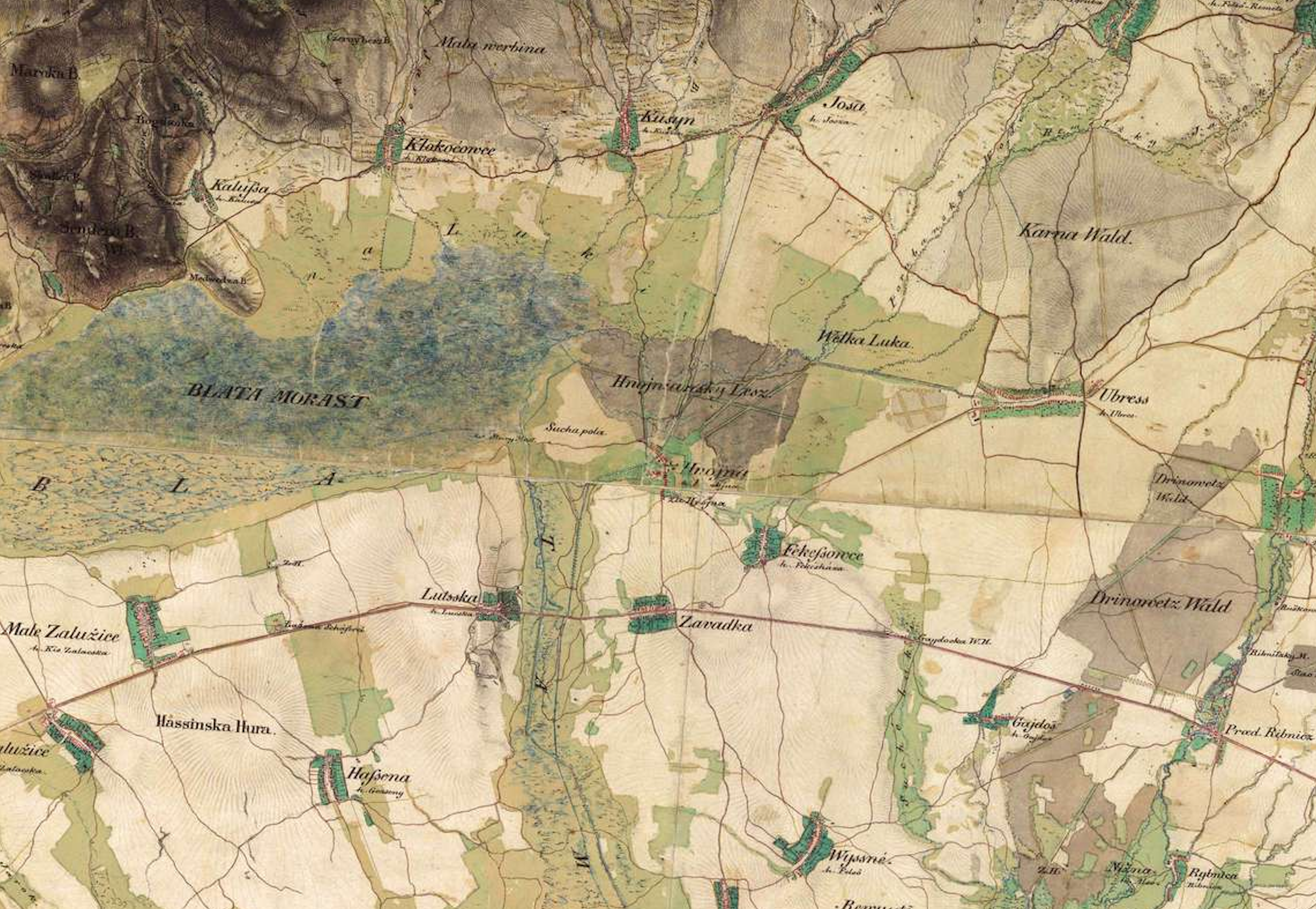
Because two other military maps were created over the next 100 years of this same area, I can use those maps to see how it changed over time. Below is the map from the second military survey from the early 1800s. Now the lake area is labeled “Blata Morast” which Google Translate shows is Slovenian for “Quagmire” – an ancient term we might expect for what we call today a wetland. It also looks like more area around Ubrez has been cleared which could have opened up more land for farming possibly needed because the number of homes in Ubrez appears to have at least doubled.
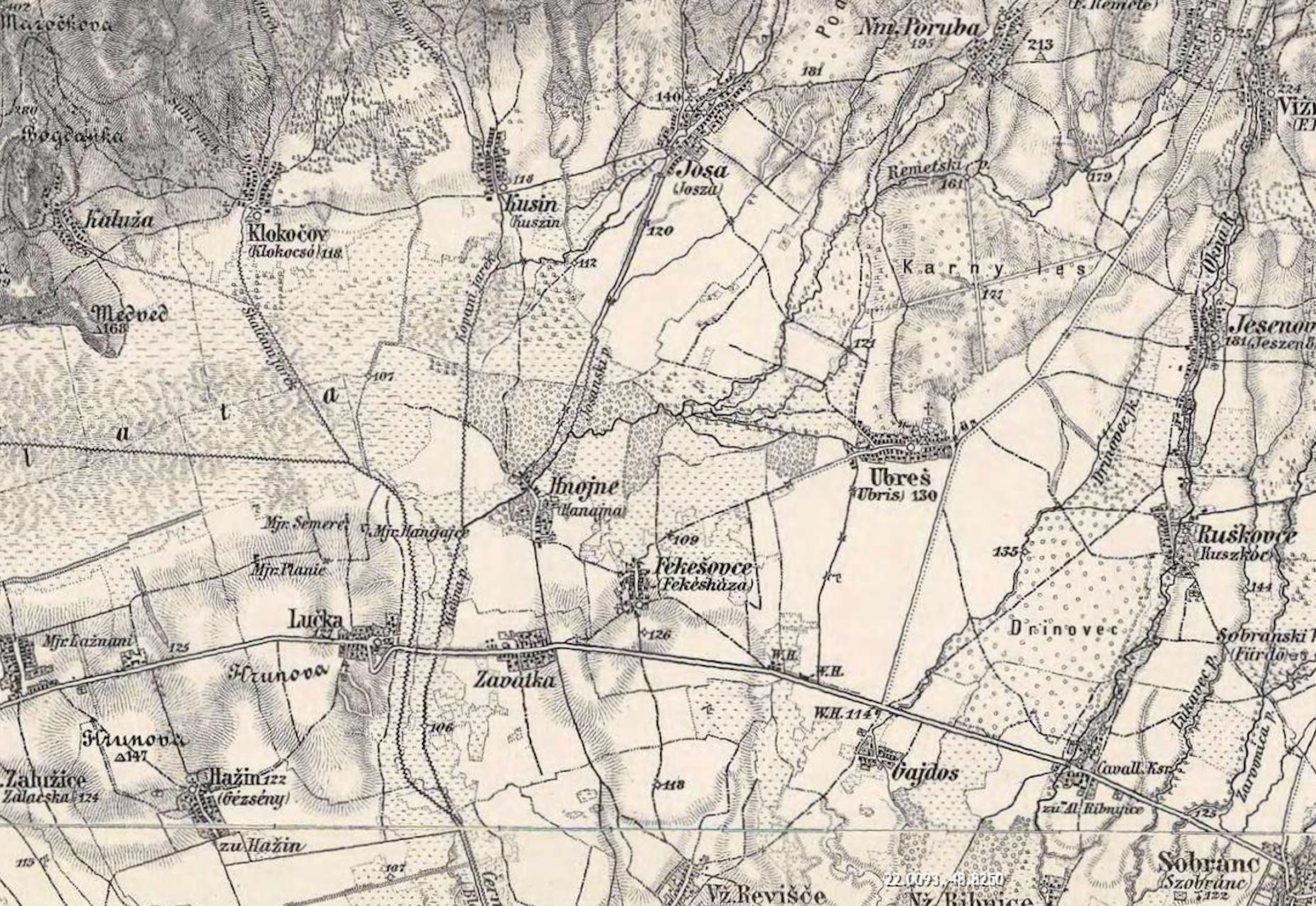
The final map in the military series from the late 1800s is shown below. The lake area is now referred to as “Blata” for which I could not find a translation. The number of homes in Ubrez appears to have held fairly steady along with the area of clearing primarily to the south of the village.
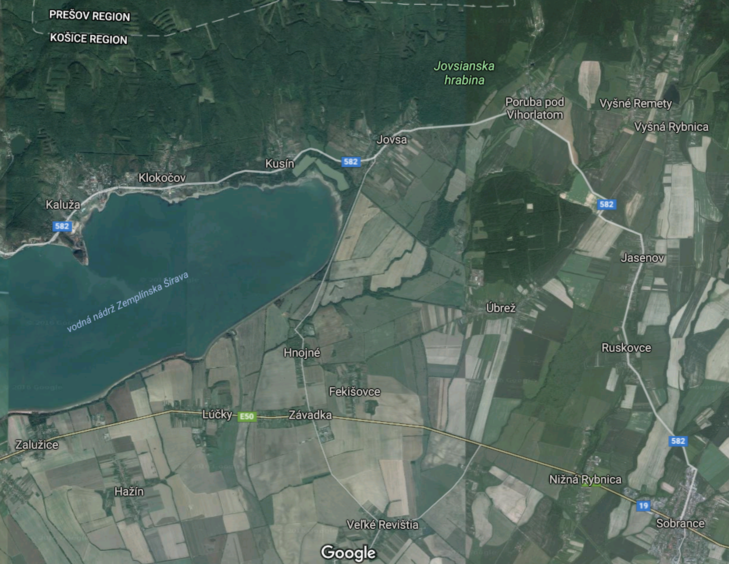
Finally, below is an aerial view of Ubrez and the surrounding area in 2016 from Google. The lake can be seen west of the village. Also, if you could zoom in on the photo, you could see the number of homes in Ubrez has increased over the last 100+ years with many now located along the north-south road lying at the eastern section of the village. Much of the land around Ubrez looks like it is still farm fields with a larger stand of forest lying to the north.
Because of the detail on maps like these, I’ve also found it helpful to go back from time to time to look at them more closely. It’s easy to miss tiny details that might offer additional information about the life of my ancestors.